But really, are you sure? The northern part of it is mostly the Arkansas border with some fingers come out here and there. The rest of it looks like it’s mostly along the Mississippi. (which is still nonsense of course)
I stumbled across this youtube video on a methodology for redistricting. Seems like it could be great if applied equitably, but also could be a tool for extreme gerrymandering. The video is more technical rather than political.
I know this isn’t really the spirit of the thread, but this was interesting to me:
An apportionment act in 1901 … added that districts should not only be of equal population and contiguous but also be of “compact territory.” These provisions were also included in 1911’s apportionment act …
In 1929 Congress passed a combined census-reapportionment bill which established a permanent method for apportioning House seats according to each census. This bill neither repealed nor restated the requirements of the previous apportionment acts – that districts be contiguous, compact, and equally populated.
But, in 1932 the supreme court ruled that each reapportionment act only applied to one reapportionment. So the “compact” did not automatically carry forward.
So we actually had anti-gerrymandering laws in effect for the 1900, 1910, and 1920 reapportionments.
And, Congress could pass an anti-gerrymandering law yet this year and it would apply to the 2020 reapportionment. Should have been passed by now.
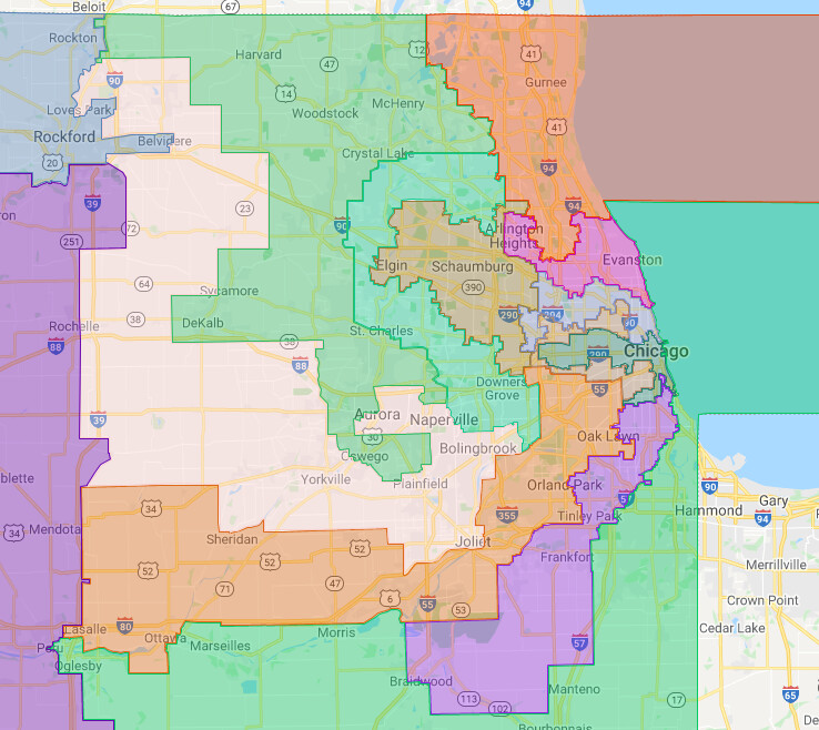
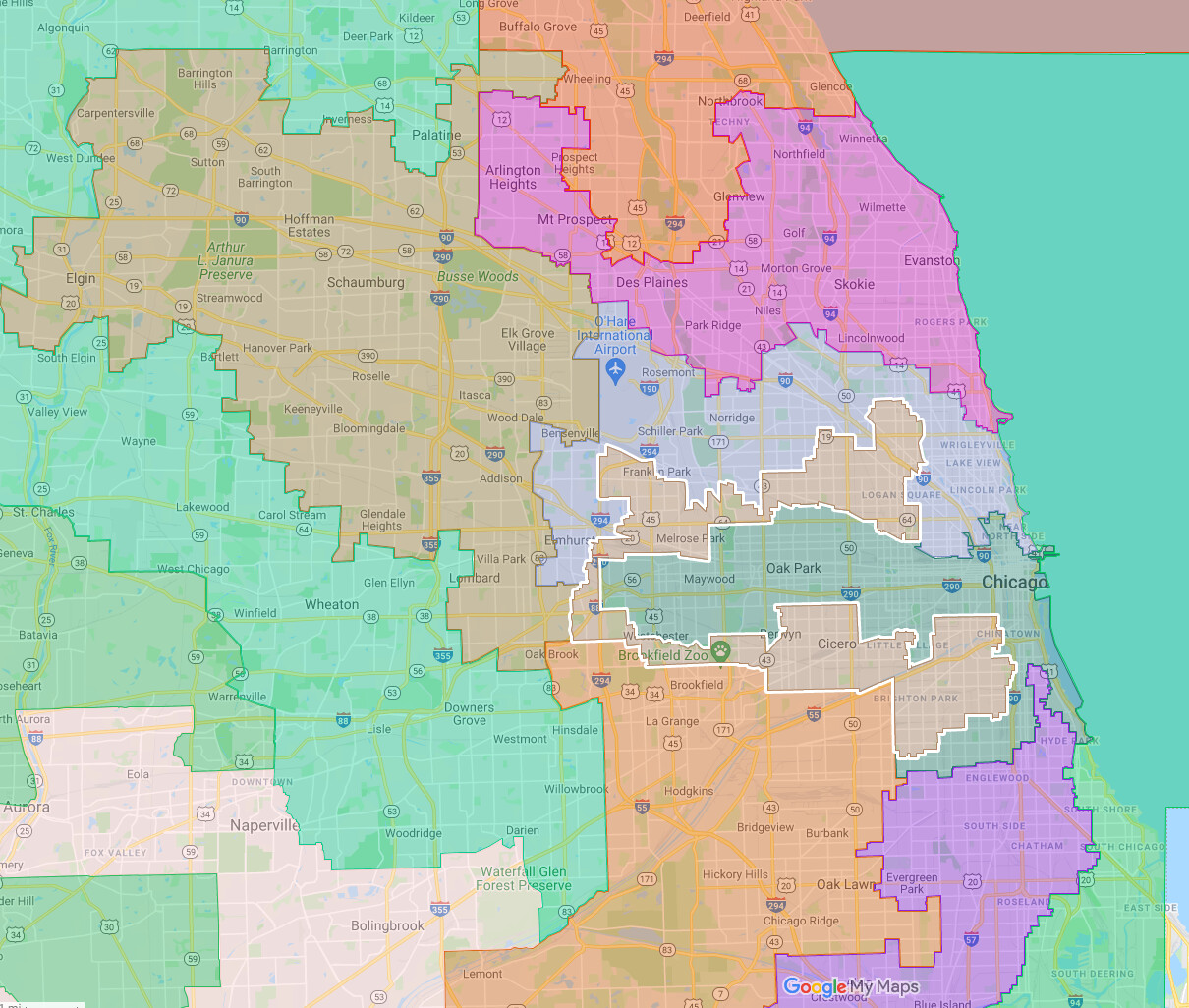
I think it’s hilarious that so many people on this board bitch about Republican gerrymanders, yet this one is a horridly flagrant Democrat gerrymander. The post focused on the Chicago area, which has Earmuffs and is bad, but then zoom out and look in the middle. The snake running from Champaign to Springfield to the St. Louis Metro is even worse.
It’s just as bad when Democrats do it like that one. And in the past the Democrats abused Gerrymandering no question, but lately most, not all, but most of the gerrymandering maps are coming from Republicans these days.
Texas, Oklahoma, Ohio, Indiana and Arizona have all but said or already put forth gerrymandered maps to shore up Republican districts and/or eliminate Democratic ones. And that’s just the ones I’ve see in the past 2-3 weeks.
Illinois is the only Democratic state I’m aware of that’s specifically trying it.
The fact that you left out the worst example does not help your credibility. Anyways, people on here complain about it at the state level, and I have seen zero evidence that one side is worse than the other except for cherry-picked examples.
Ok that’s 5-2. But the initial Maryland map gives a seat to Rs under the Republican Governor plan, though the Democratic legislature is likely to say FU and drawn a more favorable D map.
But states like these on both sides just show the need for a federal anti-gerrymandering law.
But John I Hate Voting Rights Roberts and the High Court of Gilead would probably just rule it unconstitutional interference with states rights.
Why are they going after Kinginer’s district in IL? He’s been the most un-Trump-Republican Republican in the state. Are they just assuming he gets knocked out in the next primary by a Trump Republican?
I have to agree with @Daggett here. I think people who have power try to keep it, on both sides. I grew up in the one Republican district of Massachusetts, and saw it gerrymandered away when i was in… Probably high school, although I don’t recall for sure.
We are mostly seeing it in Republican states right now because those are the ones rewriting Congressional boundaries at the moment.
Oh, there are lots of bad ones. I don’t really care who makes them, I just find them hilariously cynical.
It’s not like it’s a secret as to why they’re making these bizarre-looking districts. We can get something like rotten boroughs in the U.S., because they’re set by total population, not by total eligible voters (never mind about total people who actually vote).